Perception Software for Autonomous Vehicles

Automotive-Grade Perception Software

Innoviz’s advanced perception software, a tool for extracting additional 3D point cloud data, is designed to be the perfect complement to the company’s hardware offerings and provides vehicles with a deep understanding of any 3D driving scene. Innoviz was one of the first LiDAR companies to develop perception software to accompany its LiDAR products.

car projecting on tablet and lidar
Perception Software gif
LiDAR vs Camera for product page

3D LiDAR Point Cloud Perception Software Solution

The perception software leverages the rich data derived from Innoviz’s LiDAR sensors, coupled with proprietary state-of-the-art AI algorithms, to provide leading objection detection, classification, and tracking features, as well as collision classification, localization, and calibration capabilities.

Enhancing Safety by Deploying Both LiDAR Software & Hardware

When deployed alongside and in combination with other sensors’ perception algorithms, Innoviz’s software complements them to enhance performance and safety. The perception software is very resource-efficient and requires low computing power, making it compatible with various automotive-grade computing platforms. This achievement is a key differentiator against hardware-only LiDAR providers.

Key Features

Object Detection, Classification & Tracking

Pixel Collision Classification

Continuous Calibration

Blockage and Range Estimation

ISO 26262 Compliant

Lane Marking

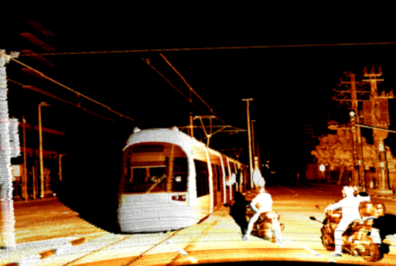
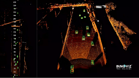
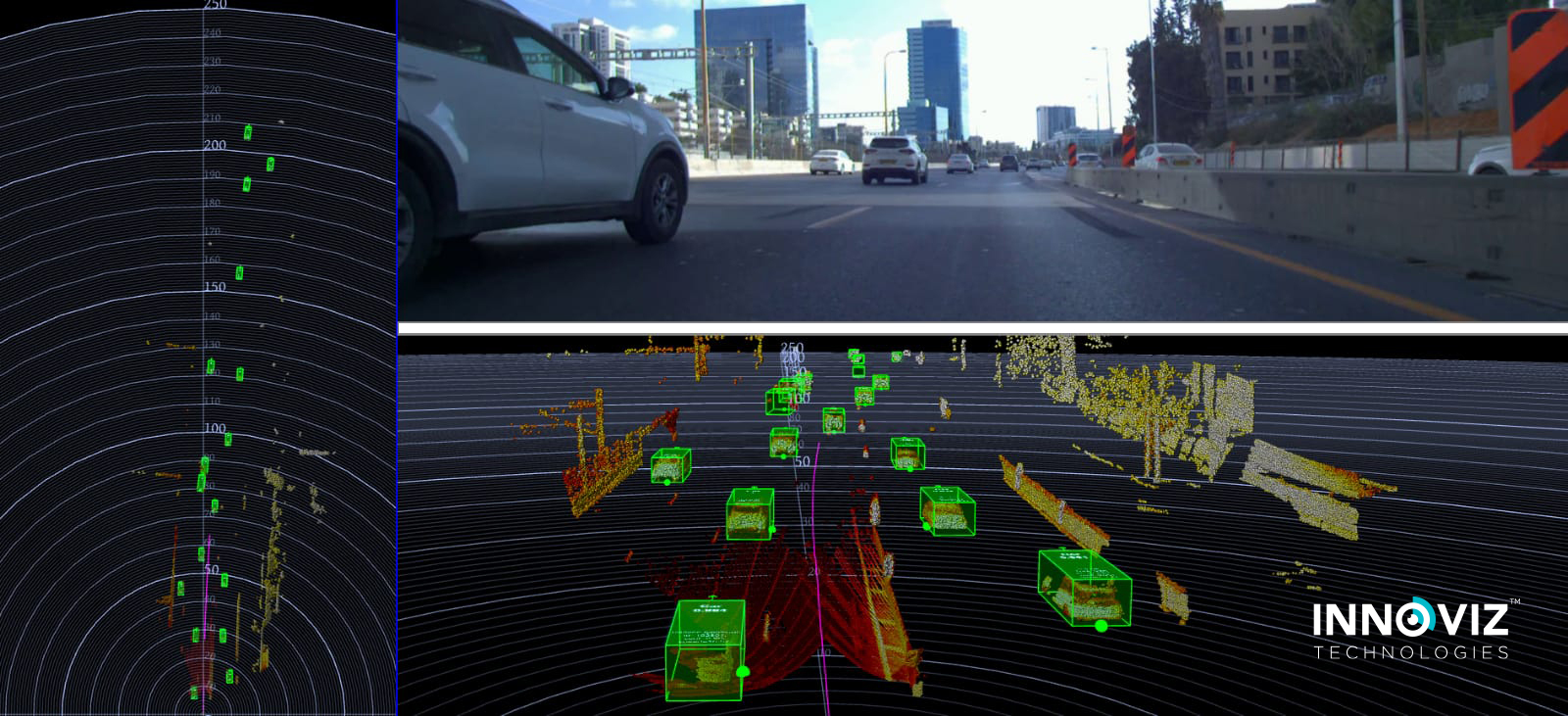
Object Detection, Classification, and Tracking

Detects objects with high precision. Boasts two independent detectors for identifying objects (i.e. cars, trucks, motorcycles, pedestrians, bicycles) as they appear through their shape and other attributes, and due to their movement. Delivers both high-quality object detection as well as more advanced object tracking (the ability to designate the same object as such in consecutive frames).

Pixel Collision Classification

Accurately identifies the driveable area for autonomous and semi-autonomous vehicles by classifying each object in the 3D environment as collision-relevant or non-collision-relevant with pixel-level data accuracy. Collision-relevant subclasses are broken down into “objects” (i.e. car, truck, bicycle) or “obstacles”, the latter consisting of anything not classified as an object (i.e. tire, debris).

Continuous Sensor & LiDAR Calibration

Calibrates between the sensor’s coordinate system and the vehicle’s coordinate system following vehicle mounting in the assembly line. Also fixes pixels’ spatial displacement, which can occur while driving on bumps and potholes, and due to acceleration and deacceleration.

Point cloud tram